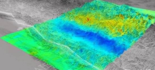
On May 7th, Sichuan Provincial Key Laboratory of Earthquake Early Warning and Chengdu High-tech Disaster Reduction Institute announced in Chengdu High-tech Zone: China will build the first underground cloud map network for earthquake prediction in Sichuan and Yunnan – by installing about 2,000 underground on the surface. The cloud map monitoring station collects the dynamic evolution information of stress and energy from 8 km to 20 km underground, and transmits it to the monitoring center to generate dynamic underground stress and energy monitoring network in real time.
"Ultimately, we will be able to carry out automatic or manual analysis and research on underground cloud maps in a manner similar to weather forecasting 'seeing the weather in the cloud' to promote the prediction of earthquake research." National "Thousand Talents Program" experts, Chengdu High-tech Disaster Reduction Wang Hao, director of the institute, said that this is a new attempt for earthquake prediction research.

Traditional earthquake rapid reports and early warnings are post-earthquake monitoring. It is impossible to “see†the dynamic evolution of underground stress and energy at any time, while the underground cloud map is a “knock-knock†for improving the ability of earthquake prediction and scientific research. “Earthquake prediction is a difficult problem in the world. The difficulty lies in the inaccessibility of the earth, the complexity of earthquakes and the small probability of repeated earthquakes at the same place.†Wang Wei said that the main scientific goal of the newly constructed Sichuan-Yunnan underground cloud map network is To solve the imminent earthquake prediction problem of shallow earthquakes (depth less than 20 kilometers). The imminent earthquake forecast refers to the forecast made by a devastating earthquake that may occur within a few days of a certain area and within a small range.
He said that the underground cloud map network does not need to “punch†deep underground, and can grasp the underground stress and energy in real time. At the same time, the occurrence of earthquake is a mechanical process, and the occurrence of earthquake is only related to the accumulation of stress, energy and the fracture strength of the fault. For the imminent earthquake forecast, there is no need to consider the complexity of the earthquake. Finally, earthquakes frequently occurring in the area covered by the Sichuan-Yunnan underground cloud map network will provide a large amount of effective data to promote earthquake prediction research.
In order to realize the construction of underground cloud maps, the Wang Hao team has developed a new type of sensor. When the stress and energy information are transmitted from the underground to the surface 20 kilometers, the physical quantity monitored by the sensor requires a transmission time of the second. “These sensors are installed on the surface, but through physical methods, they can monitor the stress and energy from 8 km to 20 km underground.†Wang Wei said that based on this sensor, earthquake prediction research can collect clear physical relations. The data is no longer the unclear physical quantity such as “chicken flying dog jumping, crossing the streetâ€, and it is no longer a physical quantity that is too indirect physical relationship such as groundwater level and water temperature, but the direct and earthquake occurrence of underground stress and underground energy. Areas and earthquake magnitudes have direct physical quantities to predict earthquakes.
According to the scientific research plan, the Sichuan Provincial Key Laboratory of Earthquake Early Warning and the Chengdu High-tech Disaster Reduction Institute will complete the Sichuan-Yunnan underground cloud map network in one to two years; in another three years, the newly constructed underground cloud map network will be used to collect about 10 destructive earthquakes. Cases, internal technical tests for earthquake prediction, etc. At present, the first underground cloud network monitoring station and sensing equipment have been deployed at the Yingxiu Seismic Station in Wenchuan County.
The reporter learned that the China Earthquake Administration announced a number of plans such as “transparent crust†last year to further understand the crustal situation and understand the law of earthquake occurrence. Wang Wei said that the "transparent crust" and other plans to detect targets are more ambitious, including both crustal structure and stress parameters, but the focus of the underground cloud map is stress and energy, the number of sensors, parameters, types, etc. used with the "transparent crust" The project is different.
3.0mm Pitch
3.0mm Pitch
ATKCONN ELECTRONICS CO., LTD , https://www.atkconn.com